Where Is Queen Elizabeth National Park Located? A Complete Guide to Uganda’s Most Accessible Safari Destination
Overview of the Location of Queen Elizabeth National Park
Queen Elizabeth National Park is located in western Uganda, within the Albertine Rift Valley, one of Africa’s most ecologically diverse regions. The park stretches across several districts including Kasese, Rubirizi, Rukungiri, and Kamwenge, covering approximately 1,978 square kilometers. Its strategic position between mountain ranges, crater lakes, savannah plains, wetlands, and tropical forests makes it one of the most geographically varied protected areas in East Africa.
The park lies about 400 kilometers southwest of Kampala, Uganda’s capital city, making it accessible by both road and air. Travelers can reach the park in approximately six to seven hours by vehicle, depending on the route taken and road conditions. Its location also allows it to connect easily with other major safari destinations in southwestern Uganda, making it a central component of many wildlife itineraries.
Geographic Position Within Uganda
Queen Elizabeth National Park occupies a unique position in Uganda’s western tourism corridor. It sits between several prominent conservation areas, creating a continuous ecosystem that supports wildlife migration and biodiversity. To the northeast lies Kibale National Park, famous for chimpanzee tracking, while to the south are the gorilla trekking destinations of Bwindi Impenetrable National Park and Mgahinga Gorilla National Park.
The park’s location also places it near international borders. It extends to the western boundary of Uganda, where it meets the Democratic Republic of Congo, with the magnificent Rwenzori Mountains forming a dramatic backdrop along part of the frontier. This transboundary ecosystem contributes to the region’s ecological richness and conservation importance.
The Albertine Rift Valley Setting
The Albertine Rift Valley is one of Africa’s most biologically significant regions, and Queen Elizabeth National Park lies directly within it. This geological formation, part of the larger East African Rift System, creates diverse landscapes including escarpments, volcanic craters, lakes, and fertile plains. The varied terrain supports a wide range of habitats, from savannah grasslands to wetlands and forests.
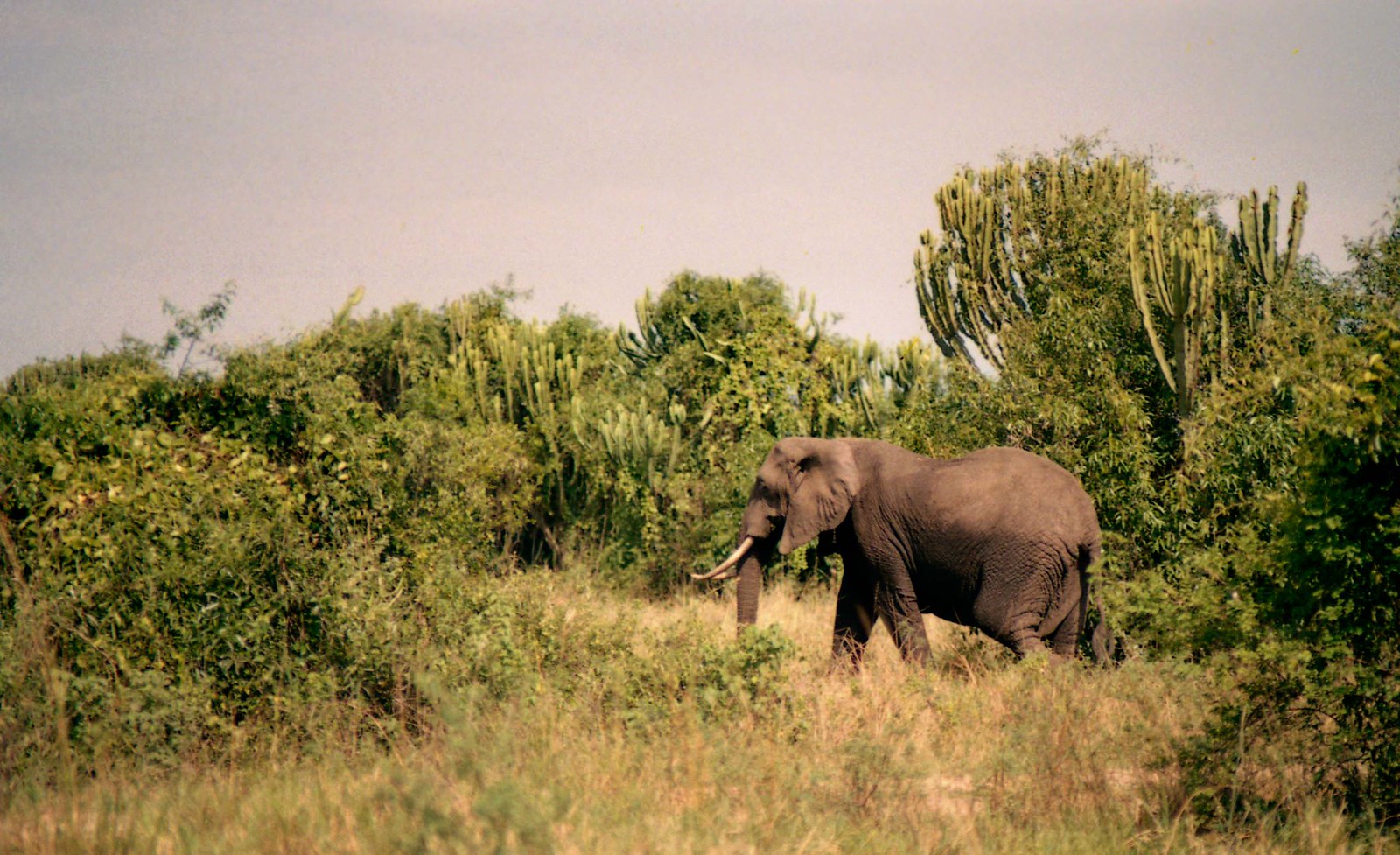
This rift valley location contributes to exceptional biodiversity. The park is home to over 95 mammal species and more than 600 bird species, making it one of the most species-rich national parks in Africa. The presence of lakes, rivers, and wetlands within the rift enhances ecological productivity and wildlife density.
Lakes and Water Bodies Surrounding the Park
Water plays a central role in defining the park’s geography. Queen Elizabeth National Park is bordered by Lake Edward to the southwest and Lake George to the northeast. These lakes are connected by the famous Kazinga Channel, a natural waterway that supports one of the highest concentrations of hippos in Africa along with numerous crocodiles and birds.
The lakes influence both wildlife distribution and human activity. Fishing communities live near the shores, and the water bodies attract animals year-round, making them prime areas for game viewing and boat safaris. The Kazinga Channel in particular is one of the park’s most popular attractions because of its accessibility and abundant wildlife sightings.
Proximity to Major Towns and Cities
The nearest major town to the park is Kasese, located near the northern sector. Kasese serves as a gateway for visitors, offering accommodations, supplies, and transportation services. Other nearby towns include Rubirizi and Katunguru, which are close to park entrances and tourism facilities.
The park is also connected to other regional hubs. Travelers coming from southwestern Uganda often access the park via towns such as Mbarara or Kabale, especially when combining visits with gorilla trekking or lake tourism. This network of towns enhances accessibility and supports tourism infrastructure.
Accessibility and Transportation Routes
Road travel is the most common way to reach Queen Elizabeth National Park. The primary route from Kampala passes through Mbarara and Bushenyi before entering the park via Katunguru or Mweya. Another scenic route runs through Fort Portal and Kibale National Park, allowing travelers to combine chimpanzee tracking with wildlife safaris.
Air travel offers faster access. Domestic flights operate from Entebbe International Airport to nearby airstrips such as Mweya, Kasese, and Ishasha, reducing travel time significantly. These flights are particularly popular among luxury travelers or those with limited schedules.
The park’s central location within Uganda’s tourism circuit makes it highly convenient. Many safari itineraries combine Queen Elizabeth National Park with Bwindi, Kibale, and other destinations without requiring excessive travel distances.
Different Sectors of the Park and Their Locations
Queen Elizabeth National Park is divided into several sectors, each with unique landscapes and wildlife experiences. The Mweya Peninsula lies between Lake Edward and the Kazinga Channel and is considered the tourism hub of the park. It offers lodges, boat safaris, and game drives.
The Ishasha sector is located in the southern part of the park. This region is famous for its tree-climbing lions, which are rarely seen elsewhere in Africa. Ishasha’s remote location provides a more exclusive safari experience compared to the busier northern areas.
The Kyambura Gorge sector lies in the eastern part of the park. This dramatic forested valley is known for chimpanzee tracking and scenic landscapes. Each sector’s location contributes to the park’s overall diversity and appeal.
Relationship With Nearby Conservation Areas
Queen Elizabeth National Park forms part of a larger conservation landscape in western Uganda. Its proximity to Kibale, Bwindi, and the Rwenzori Mountains National Park creates opportunities for multi-ecosystem safaris within a relatively small geographic area.
This regional connection enhances tourism and conservation. Wildlife corridors and shared ecosystems allow species to move across boundaries, while tourism circuits encourage longer visitor stays and economic benefits for local communities.
Climate and Environmental Influence of Location
The park’s location along the equator influences its climate. Temperatures remain relatively warm throughout the year, while rainfall patterns create distinct wet and dry seasons. The surrounding lakes moderate temperatures and support vegetation growth, contributing to year-round wildlife presence.
Altitude variations across the park create microclimates. Areas near the rift valley floor are hotter and drier, while regions closer to the mountains receive more rainfall and support different vegetation types. This environmental diversity enhances the range of habitats within the park.
Strategic Importance for Tourism in Uganda
Queen Elizabeth National Park’s location makes it one of Uganda’s most visited safari destinations. Its accessibility from Kampala, proximity to other attractions, and diverse wildlife experiences attract both international and domestic travelers.
The park serves as a central link in Uganda’s tourism industry. Many travelers visiting for gorilla trekking also include Queen Elizabeth in their itineraries, creating combined wildlife experiences that showcase the country’s ecological richness.
Cultural and Community Context Around the Park
Communities surrounding the park contribute to its cultural landscape. Fishing villages near Lake Edward and pastoral communities around the savannah plains provide cultural experiences alongside wildlife tourism. The location within populated districts highlights the balance between conservation and human livelihoods.
Community tourism initiatives are growing in importance. Cultural tours, craft markets, and local experiences allow visitors to engage with residents while supporting sustainable development around the park.
Why the Location Makes Queen Elizabeth National Park Unique
Few African national parks offer such geographical diversity within a single protected area. The combination of savannah, wetlands, forests, crater lakes, and mountain backdrops creates a scenic and ecological variety rarely matched elsewhere.
The park’s position within the Albertine Rift also contributes to exceptional biodiversity. Many species found here are endemic to the region, increasing its global conservation significance.
Conclusion: A Perfectly Positioned Safari Destination
Queen Elizabeth National Park’s location in western Uganda makes it one of Africa’s most accessible and diverse wildlife destinations. Positioned within the Albertine Rift Valley and surrounded by lakes, mountains, and forests, the park offers a unique combination of scenery and biodiversity.
Its proximity to major towns, transportation routes, and other national parks enhances its appeal for travelers. Whether visited as a standalone safari or part of a broader Ugandan itinerary, Queen Elizabeth National Park’s strategic location ensures unforgettable wildlife experiences in one of East Africa’s most remarkable landscapes.