
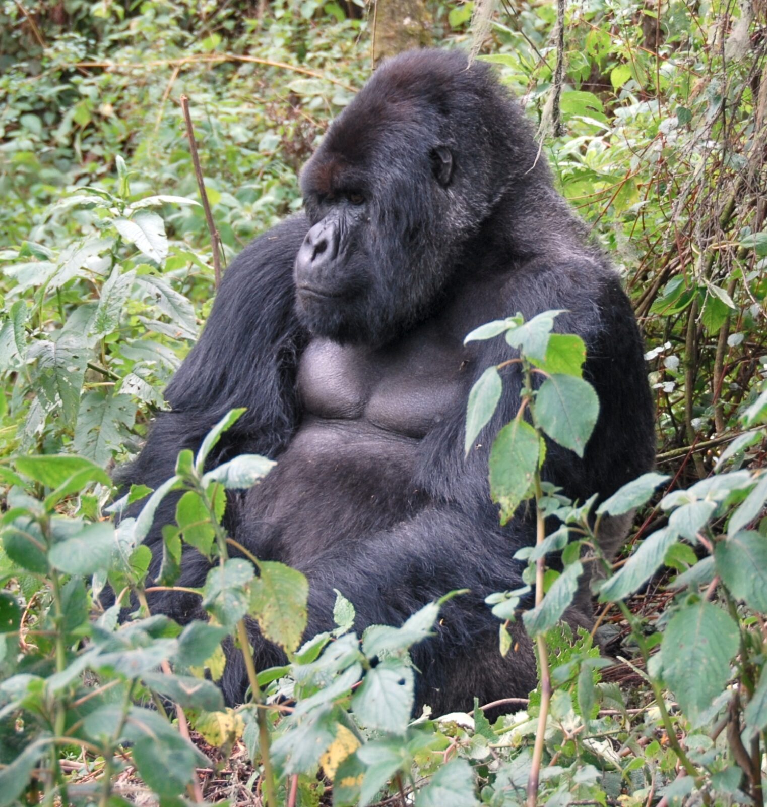
Mountain gorillas live in two islands of forest, both of them small, both of them hemmed in on nearly every side by some of the densest farmland in Africa. Gorilla habitat loss isn’t a single dramatic event you could point a camera at – nobody cleared Bwindi Impenetrable Forest in an afternoon. It happens field by field, tree by tree, along the edges of land that was never especially large to begin with, and it has been happening for over a century. Understanding where that pressure actually comes from changes how you see the forest once you’re standing inside it, on a trail a ranger has walked a thousand times before you.
Two Forests, Not One Continuous Range
There are two separate mountain gorilla populations left on Earth, and they don’t overlap. One lives in the Virunga Massif, a chain of eight extinct and dormant volcanoes straddling the borders of Uganda, Rwanda, and the Democratic Republic of Congo, split between Mgahinga Gorilla National Park, Volcanoes National Park, and Virunga National Park. The other lives roughly 25 kilometres north of the Virungas, entirely within Uganda, in Bwindi Impenetrable Forest and the adjoining Sarambwe Nature Reserve just across the Congolese border.
Together, these two ranges add up to a few hundred square kilometres of protected forest – a footprint you could drive across in a couple of hours if the roads were straight, which they aren’t. For most of the twentieth century, that footprint was shrinking rather than growing, and the reason had almost nothing to do with the gorillas themselves.
What’s Actually Driving the Loss
It’s tempting to picture habitat loss as poachers or loggers acting with the gorillas specifically in mind. In practice, the pressure on this forest comes almost entirely from people trying to feed their families and heat their homes, in a part of the world where the land around the parks carries some of the highest rural population densities on the continent.
Farmland Pressing Against the Boundary
Kisoro district in southwestern Uganda, which borders both Mgahinga and part of Bwindi, is one of the most densely populated rural areas in the country. Families here have farmed the volcanic soil for generations, and that soil is genuinely excellent – rich, well-drained, ideal for the potatoes and beans that feed the region. The trouble isn’t bad farming. It’s that there is very little land left to farm that doesn’t already touch a park boundary, so every generation that needs new plots ends up a little closer to the treeline than the last.
This isn’t a hypothetical. Before Rwanda’s Volcanoes National Park was gazetted in its current form, roughly a third of its original area was cleared in the 1960s and 70s for a European-backed pyrethrum farming scheme, meant to grow flowers for insecticide production. The scheme mostly failed economically, but the forest it cleared never grew back. That one decision is part of why the Virunga side of the population has less room to roam today than it did a hundred years ago.
Firewood, Charcoal, and the Economics of Cooking
Across the region, most households still cook over wood or charcoal, because it’s what’s affordable and available. Inside well-patrolled parks like Bwindi and the Ugandan and Rwandan sides of the Virunga, illegal logging is now rare and heavily policed. It’s a different picture on the Congolese side, where Virunga National Park has operated for years under the added strain of armed conflict, weak state presence in some sectors, and an entrenched charcoal trade known locally as makala. Charcoal production there has at times been linked directly to militia financing, which makes it one of the harder threats to solve with a park boundary and a ranger patrol alone – the incentive to cut is tied up with money that has nothing to do with cooking fuel.
Livestock at the Forest Edge
Cattle and goats don’t respect a painted boundary post any more than gorillas do. Grazing pressure along the forest edge compacts soil, strips undergrowth that would otherwise regenerate, and in places has pushed the usable edge of gorilla habitat inward by a discouraging amount over the decades. It’s a slower, quieter form of loss than a logging operation, and partly for that reason it’s harder to police consistently.
Roads, Water Access, and Everyday Use
Even without any intent to damage habitat, day-to-day use of the forest edge adds up: paths worn wider for water collection, bamboo cut for building material, honey harvested with fire that occasionally gets away from the harvester. None of these on its own would threaten a population of over a thousand gorillas. Stacked together, over decades, across a forest range this size, they explain why habitat loss remains an active concern even in parks that are, by African conservation standards, unusually well protected and well funded.
Why a Shrinking Forest Threatens More Than the Gorillas
Bwindi and the Virungas sit inside the Albertine Rift, one of the most biologically rich regions in Africa, home to species found nowhere else on the planet – the Rwenzori duiker, several endemic chameleons, forest elephants, and well over 300 recorded bird species in Bwindi alone. A shrinking forest doesn’t just squeeze gorillas. It squeezes everything living in that same canopy, and it changes the water table for the farms below it. These forests act as a sponge for the region’s rainfall, and their steep volcanic slopes hold soil in place that would otherwise wash straight down into the valleys where those same farming communities grow their food. Lose enough forest and the people whose farms depend on that stability lose out along with the gorillas.
What’s Actually Being Done About It
The encouraging part of this story is that mountain gorillas are the only great ape whose population has grown in recent decades, from a low point of under 250 individuals in the 1980s to just over a thousand today, spread across both ranges. That recovery happened despite the pressure described above, not because the pressure disappeared. It happened because of a specific set of interventions that keep getting refined.
Hard Boundaries and Buffer Planting
Around large sections of Bwindi, park authorities and communities maintain a thick hedge of Mauritius thorn along the boundary – an unglamorous but genuinely effective barrier that discourages both livestock and crop-raiding wildlife from crossing in either direction, and gives rangers a clear, patrollable line to work along. Buffer zones of fast-growing trees, planted just outside the official boundary, give firewood-dependent households a legal, renewable source close to home instead of an incentive to cut inside the park.
Making the Forest Worth More Standing Than Cleared
Gorilla trekking tourism is, bluntly, the single biggest reason this conservation model works at all. A permit that costs several hundred dollars per trekker translates into revenue-sharing programmes that fund schools, clinics, and roads in the communities bordering the parks, alongside direct payments tied to conservation performance. When a forest edge is worth more as a source of tourism revenue and ranger salaries than as another acre of farmland, the calculation for local communities genuinely shifts – not overnight, and not for everyone, but measurably, over the decades this model has now been running.
Cross-Border Cooperation
Because the Virunga population moves freely across three national borders, no single country’s park authority can protect it alone. The Greater Virunga Transboundary Collaboration links Uganda’s Wildlife Authority, Rwanda’s Development Board, and Congo’s ICCN in joint patrols, shared veterinary response for sick or injured gorillas, and coordinated anti-poaching operations that don’t stop just because a gorilla family wanders across a boundary line on the ground.
Reforestation and Corridor Projects
Newer initiatives focus on rebuilding, not just holding the line – replanting degraded sections of forest, and in some areas working toward corridors that could eventually reconnect fragments of habitat isolated by decades of clearing. This is slow work, measured in tree cover that takes twenty or thirty years to mature, but it’s the only long-term answer for a population that is already recovering in numbers yet still confined to a smaller range than it once had.
What This Means for You on a Gorilla Trek
None of this is background trivia you can skip on the way to the trailhead. The permit fee you pay before your trek is, in a very direct way, the mechanism funding everything described above – the ranger salaries, the buffer zone planting, the revenue-sharing that keeps the forest edge more valuable intact than cleared. Choosing an operator that pays its guides and porters fairly, and that genuinely supports the community programmes tied to the park rather than treating the permit as a pure pass-through cost, extends that same logic a little further. It’s worth asking your operator directly how they engage with the communities bordering the park you’re visiting – a good one will have a specific answer, not a vague gesture toward “supporting conservation.”
Frequently Asked Questions
Is mountain gorilla habitat still shrinking today?
Within Uganda and Rwanda, the core protected areas are now legally fixed and well enough patrolled that outright clearing inside the park boundary is rare. The pressure today comes mostly from the edges – grazing, firewood collection, and encroachment in less-patrolled sectors – rather than large-scale clearing inside the gazetted parks themselves. On the Congolese side of Virunga National Park, loss remains a more active and harder-to-control problem, tied to the region’s ongoing security situation.
How much forest do mountain gorillas actually have left?
Between Bwindi, Sarambwe, and the three parks making up the Virunga Massif, the total protected range adds up to a few hundred square kilometres – small by the standards of most large-mammal conservation, which is part of why the population’s recovery despite that constraint is considered such an unusual conservation success story.
Does gorilla trekking tourism help or hurt habitat loss?
Done properly, it’s one of the main things holding the line against it. Permit revenue funds the ranger patrols and community programmes that make the forest more valuable intact than cleared for the people living along its edge, which is the underlying economic driver of habitat loss in the first place.
Why can’t the parks just expand to give gorillas more room?
Because the land immediately outside every park boundary is already farmed, in most cases by families who have worked it for generations. Expanding the boundary would mean displacing people who depend on that land, which is a different and much harder problem than reforesting degraded land or improving how existing park land is managed – most current conservation strategy focuses on the latter rather than pushing outward.
If you’re planning a trek and want to understand more of what your permit fee actually supports, it’s worth reading about how local communities around Bwindi are directly involved in protecting the forest, or how Rwanda’s gorilla population recovered from a genuine low point. The cross-border cooperation between Uganda, Rwanda, and the DRC is also worth understanding before you book, since it shapes which sector and which country ends up being the right fit for your trip. And if the economics of tourism funding conservation interest you, this look at how tourism dollars protect wildlife in Uganda goes into more detail on where the money actually goes once you’ve paid for your permit.